


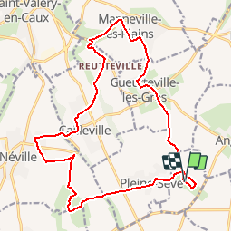
Les Amouhoques - Le Mesmil-Durdent

tracegps
User

Length
18.9 km

Max alt
96 m

Uphill gradient
243 m
Km-Effort
22 km

Min alt
36 m

Downhill gradient
245 m
Boucle
Yes
Creation date :
2014-12-10 00:00:00.0
Updated on :
2014-12-10 00:00:00.0
2h00
Difficulty : Difficult

FREE GPS app for hiking
 SityTrail
IGN / Geographical institutes
SityTrail Plus
The world is yours!
About
Trail Other activity of 18.9 km to be discovered at Normandy, Seine-Maritime, Le Mesnil-Durdent. This trail is proposed by tracegps.
Description
Jardin et parcours botanique sur la flore sauvage cauchoise du Mesnil-Durdent. Belles chaumières et château du Mesnil Geogffroy à proximité.
Photos


Positioning
Country:
France
Region :
Normandy
Department/Province :
Seine-Maritime
Municipality :
Le Mesnil-Durdent
Location:
Unknown
Start:(Dec)
Start:(UTM)
339655 ; 5520716 (31U) N.
Comments